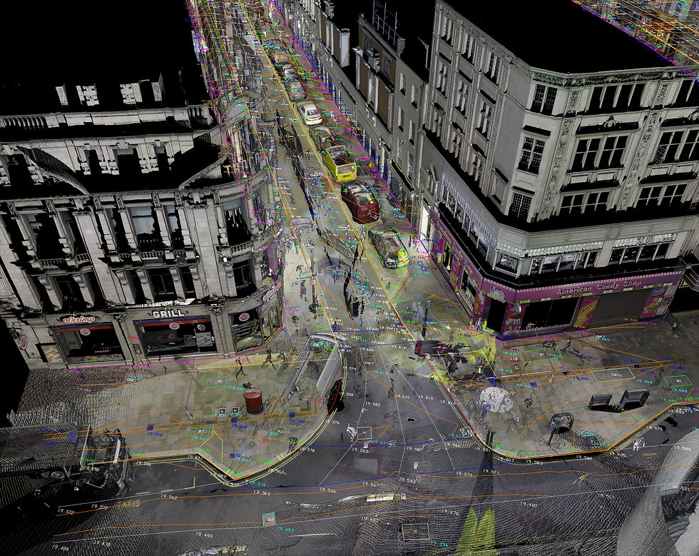
Project: Chinatown Topographical Survey
Client: Roadways Consulting
Borough: City Of Westminster, London
Introduction
As one of London's most iconic neighbourhoods, Chinatown has long been celebrated for its rich culture and vibrant energy. But behind its bustling streets and colourful storefronts lies a complex landscape that has evolved over time. To truly understand the topography of Chinatown, and the challenges faced by its residents, a detailed survey was needed. Such a survey would provide valuable insights into the unique landscape of this historic neighbourhood, including its buildings, streets, and public spaces. By conducting a comprehensive topographical survey of Chinatown, the designers wanted to gain a deeper understanding of this iconic neighbourhood.
Challenges and Approach
We decided to carry out the works at nights when there are less people on the streets. We used our RTC360 laser scanner to complete the site survey as this was the quickest and most efficient way to capture all the data we needed. Due to the large size of the area, the survey control had to be established with traversing. The control point coordinates were computed using least squares method. The resulting coordinates were the base of the survey control, onto which the scanning data was transformed. We completed the site works in just three days and continued the work in the safety of our office.
Results
We have managed to create highly detailed topographical survey drawings both in a flattened 2D map and a 3D model which can be imported directly into all major design software, including AutoDesk Civil3D.
Conclusion
The project was successfully completed within deadline and budget. Because of the chosen method of scanning, we were able to provide the client with added information on top of the agreed deliverables namely a dense point cloud and a Street View like representation of the area.
The final deliverables were:
2D dwg file
3D dwg file
LGS file to use in Leica TrueView, a streetview like presentation where measurements and notes can be added by the client.
It was a great learning opportunity for us too to see how well the scanning data fits the highly precise survey control system.


